Thursday, May 26, 2011

Slight Improvement in the Ongoing Drought

After receiving an average of 1-3" of rain from two storm systems in as many weeks, the vegetation and plants have perked up just a bit.


In driving around town earlier this week, I could not help but notice the grass looks a little greener and the ground not as crunchy as it did when we started the month.


While we still have a significant drought ongoing, things have improved slightly for most of us, thanks to some soaking showers and thunderstorms the past couple of weeks.


The image left is from a few weeks ago. Notice that pretty much all of Deep East Texas was in an "exceptional" drought. That is a stage four drought and the worst possible stage of drought to be in.


This past Tuesday, the updated drought showed that a good chunk of East Texas has improved from an exceptional drought to an extreme drought. Even though it is only a bump up from a stage four to a stage three, at least that's an improvement.


Unfortunately, it looks like a big dome of high pressure will be building overhead this holiday weekend, meaning the heat and dry weather will be returning to the Pineywoods.


Thursday, May 19, 2011

Another Active Atlantic Hurricane Season Expected

Earlier today, the National Oceanic and Atmospheric Administration (NOAA) issued their outlook for the upcoming 2011 Atlantic hurricane season.


NOAA'S Outlook calls for 12-18 storms, 6-10 of which will become hurricanes, and 3-6 of those hurricanes being major hurricanes (category 3 or higher).


Here are the other outlooks and predictions:


Dr. William Gray and his team at Colorado St. University

16 named storms

9 hurricanes

5 major hurricanes


Accu Weather

15 named storms

8 hurricanes

3 major hurricanes


Keep in mind that an average year consists of 11 named storms, 6 hurricanes, and 2 major hurricanes. The bottom line is that all the different forecasting companies are predicting an above average year.


There are basically two main reasons why we are expecting another active hurricane season.


1.) A waning, but still existent La Nina phase, which looks to continue into the summer months. Wind shear in the upper atmosphere becomes very light, therefore, allowing storms to develop in a more favorable environment.


2.) Warmer than normal sea surface temperatures in the Gulf, Caribbean, and Atlantic ocean. This added warmth creates the extra fuel for these tropical heat engines to develop and do so at a very rapid pace.


Hurricane season officially begins on June 1st and runs through the end of November. The peak of hurricane season takes place in late August through late September.


Friday, May 13, 2011

Receiving a Nice Soaking

A slow moving storm system provided East Texans with not one, but two days of heavy rain and thunderstorms.


Round one came in on Wednesday night from North Central Texas, providing us with substantial rain for the first time in several weeks.


On Thursday, round two came in from a thunderstorm complex in South Central Texas.


When it was all said and done, several communities in Deep East Texas picked up some very nice rainfall totals.
As you can see from our weather watcher rainfall reports, many areas saw anywhere from 1-3" of rain, with Tim Martin in Broaddus reporting 3.60" and Lane Lowery in Huntington receiving 3.47".


While the rain was much welcome and needed, we still have a long way to go before our "exceptional" drought status can be reduced. Keep in mind that burn bans are still in place for all of our local counties except Houston county.

Wednesday, May 11, 2011

Precious Liquid Water to Fall from the Sky

A cold front and dryline will interact with a warm and humid airmass to give the Piney Woods a good shot at rain and thunderstorms on Thursday.

We are already seeing some light to moderate showers across East Texas this afternoon, but our better rain chances will occur on Thursday.


Our computer models have been fairly consistent on developing showers and thunderstorms over East Texas over the next 24 to 36 hours.

Whenever we see consistency on our models over a span of two to three days, that usually indicates there is fairly high confidence in that particular event taking place.

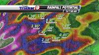
Our Microcast computer model shows that many areas could receive anywhere from 0.50" to 2.0" of rain. Keep in mind that this does not mean the total you see for your neighborhood is what you will get. This is an average rainfall amount based on potential. It is possible some of you may not even get a quarter of an inch on Thursday, while your neighbor up the road gets over an inch, depending upon where the heavier rain cells and thunderstorms develop.

Nevertheless, this is something to get excited about as we should see some decent chances for rainfall we desperately need.

Don't forget to download our newest KTRE 9 Weather App., now available for all Android and I-Phone users.

Friday, May 6, 2011

A Neat Website for Tracking Tornadoes

In light of the recent deadly tornado outbreak, there is a website that many of you might find rather useful.

If you go to www.tornadopaths.org/date , you can find tornadoes that have tracked across the United States since 1950.

Just type in your zip code and search for a specific date to find out if a tornado occurred in a specific location, including here in Deep East Texas.

So if you have ever wondered about a tornado occurring in and near your community, you can now check it out on this site.

Thursday, May 5, 2011

Summer Fest Texas

If you are looking for some entertainment this weekend, the place to be will be the George H. Henderson, Jr. Expo Center in Lufkin.


Several musicians and country music groups will be performing, starting on Friday evening at 5pm. This event will continue into Saturday, with gates opening at 10am and going through Saturday night.


Some of the music artists include Josh Abbott, Whiskey Meyers, The Lords of Denman, and the Buffalo Nickel Band to name a few.


SFA's Steel Drum Band will bring a local flavor to the party, as they will be peforming as well.


This might be the perfect thing to take mom to as an early treat for Mother's Day on Sunday.


Monday, May 2, 2011

Damaging Wind Reports

In the last blog post, you saw that the National Weather Service in Shreveport confirmed two tornadoes that touched down in Deep East Texas last Monday night (4/25/2011).

While they were down surveying storm damage, they also filed several reports of wind damage that came from the rear flank downdraft of those supercell thunderstorms.

A rear flank downdraft is an area of warm, dry air that comes with the rapid descending part of a thunderstorm. A lot of times, this fast current of winds that rushes out of a thunderstorms can create a lot of wind damage.

Here is what the NWS determined from those supercell thunderstorms last week in regards to wind damage. Note: This is the verbatim of the report they filed.

{A 2 MILE SWATH OF SEVERE WIND DAMAGE IN ASSOCIATION WITH THE REAR FLANK DOWNDRAFT FROM THE WELLS TORNADO. MINOR ROOF DAMAGE OCCURRED TO HOMES ALONG FM 1819. THE OLD REDTOWN SCHOOL AND SENIOR CITIZEN CENTER BOTH LOST PARTS OF THEIR METLA ROOFS. A BARN AND SEVERAL OUTBUILDINGS ON CHOPPIN ROAD LOST THEIR ROOFS. HUNDREDS OF TREES WERE BLOWN DOWN FROM REDTOWN TO POLLOCK ALONG FM 1819..HWY 103...HWY7 AND HWY 69. WINDS WERE ESTIMATED FROM 90 TO 110 MPH. WIDTH OF DAMAGE WAS 2 MILES WIDE.}

{A ONE HALF MILE WIDE DAMAGE PATH IN ASSOCIATION WITH THE REAR FLANK DOWNDRAFT OF THE LUFKIN TORNADO RESULTED IN SEVERAL TREES UPROOTED OR SNAPPED BLOCKING PORTIONS OF BLUE ROCK LANE...RICHARDSON ROAD AND HWY 60. WIND SPEED WAS ESTIMATED UP TO 70 MPH.}

{AT 10:40PM...NWS STORM SURVEY NOTED A FEW TREES AND NUMEROUS TREE LIMBS WERE BLOWN DOWN ALONG HWY 69 FROM SOUTH OF HUNTINGTON IN ANGELINA COUNTY TO THE JASPER COUNTY LINE. THIS WAS IN ASSOCIATION WITH THUNDERSTORM WIND DAMAGE WITH WINDS ESTIMATED AT 60-70 MPH.}

{AT 11:13PM..NWS STORM SURVEY NOTED THAT NUMEROUS TREES WERE SNAPPED AND UPROOTED ALONG AND EASWT OF HWY 63 IN ANGELINA COUNTY TO THE WESTERN SHORE OF LAKE SAM RAYBURN TO JUST NORTH OF THE JASPER COUNTY LINE. THIS WAS IN ASSOCIATION WITH THUNDERSTORMS WIND DAMAGE WITH WINDS ESTIMATED NEAR 75 MPH.}

Two Tornadoes Confirmed by the Shreveport Weather Service

After surveying the storm damage in Deep East Texas, the National Weather Service (NWS) in Shreveport has confirmed that two tornadoes touched down last Monday night.

According to the NWS, the first tornado occurred in Wells at approximately 9:37pm in the far southeastern raches of Cherokee county. The tornado was estimated to be around a quarter of a mile wide with a path length of 10 miles. This first tornado has been classified as an EF1, with winds estimated to be around 110 mph.

This tornado caused roof damage to a home on County Road 2829 and then continued into far western Angelina county, where it uprooted and damged several trees along FM 1819 and County Road 13. Several homes in the area suffered roof damage and some outbuildings were reported to be destroyed as well.

The tornado continued its path along Choppin Road near Winter Lane, before finally lifting on the west side of the Pollock community at around 10:04pm.

The NWS in Shreveport also found antoher tornado that touched down at 10:13pm in Angelina county along Richardson Road, just northwest of Lufkin. This tornado had a width of only 25 yards and had a path length of one mile. This second tornado was weaker than the one in Wells, and was classified as an EF0, with winds of around 80 mph.

During the tornadoes short one mile journey through western Angelina county, minor roof damage occurred to a mobile home on Royce Oliver Road and Richardson Road.

The best news to report from these two tornadoes is not only were there no fatalities, but no major injuries were suffered as well.

There were also reports of damaging winds that led to damage as well. Another blog entry on those results will be posted soon.